Part 4 (final) - A Much needed 2022 Western US adventure
This is the fourth (final) in a series of posts made during our 2022 US vacation.
Natural Bridges National Monument, Utah (est. 1908)
After leaving Hovenweep National Monument we headed to Natural Bridges National Monument and Bars Ears National Monument. This area is known as one of the darkest national parks in the country so attract astronomers from all over the world. We've come here four other times but I'll never forget the first time. I wandered outside at about 2:00am and found myself surrounded by the most amazing display of the Milky Way Galaxy. It was huge and showing itself off in all starry beauty.
The park itself is relatively small with three giant natural bridges: "Kachina," "Owachomo" and "Sipapu". This trip we hiked from Kachina to Owachomo but you can hike through to all three in the full loop hike (12 miles).
Sipapu Natural Bridge
 |
Hike down to Sipapu Natural Bridge
|
 |
Sipapu Natural Bridge
|
Kachina Natural Bridge
Kachina is my favorite bridge, there are some amazing petroglyphs and pictographs near it's base. Clearly native peoples lived under the shade of this bridge.
 |
There is something amazing about seeing hand prints below the Kachina bridge from native people
that lived here as long as 1,500 years ago. |
 |
Kachina Natural Bridge: It is believed that native people lived here between 500 and 1500 years ago.
Here is a further shot of the hand prints that are just above a "Kiva".
|
Owachomo Natural Bridge
 |
Owachomo Natural Bridge
|
 |
| Found a new friend along the way. |
Bears Ears National Monument, Utah (est. 2016)
Bars Ears National Monument is sacred to many Native American tribes. It's an un-developed monument and overall a little on the wild side. There is no visitor center and the roads are all dirt. The monument is approximately 1.36 million acres of public lands administered jointly with the BLM and U.S. Forest Service.
We've had trouble getting into the area in the past due to wet and muddy roads but his time it was dry so we were able to get through the road that runs right between the ears (see pic below). For those who want to adventure, there is plenty of back country to explore. For this trip though, we just decided that we were going to hike to the top of the East ear.
 |
| Bears Ears National Monument |
 |
| This marker is located just as you crest between the ears. |
 |
| I think that this is a Rocky Mountain Douglas Fur |
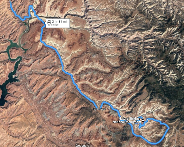
Hwy 95 from Natural Bridges National Monument to Lake Powell
The drive from Natural Bridges through Lake Powell is an absolutely beautiful drive and well worth the trip. Is winds through a dizzying number of canyons. There is much to explore here and it's been added to the future vacation To-Do list.
Camping at 9,600 feet
After leaving the beautiful canyon drive from Natural Bridges and Lake Powell, we headed toward Boulder Utah to camp for the night. The route on Hwy 12 takes you up to much higher elevations, over 9000 feet and has some beautiful vista points with stunning views of Capitol Reef National Park. At this elevation the air it cool and thin. There are Aspen and spruce trees everywhere.
We decided to camp for the night near Larb Hollow (see picture below) in a dispersed camping area and pretty much had the place to ourselves because it's early in the season and all of the campgrounds here are still closed.
Next stop,
Grand Staircase & Escalante National Monument
 |
| Our camp just outside Boulder Utah in Dixie National Forest |
Petrified Forest State Park, Grand Staircase & Escalante National Monument, Utah
We LOVE Escalante. It's a small town, there is a ton of BLM land, and there are lots of dirt roads and canyons to explore. We've been here several times in the past and always find things to keep us entertained. The Petrified Forest Sate Park is a good stopping point and has several first come first serve camping spots.
 |
| Craig petting the giant Collared Lizard at the Escalante Visitor Center |
Dinosaurs and Dirt, Escalante National Monument Utah
From Escalante, there is a road in the area called Hole In The Rock Road that is a 62 mile dirt road that runs to the Hole-in-the-Rock on the western shore of Lake Powell. We've never made it that far (that's a long drive on a dirt road) but I'm told it follows the general route of of the original Hole-in-the-Rock Expedition. However, there are several places to explore off this road. We had previously visited to Peek-a-boo and Zebra slot Canyon so we decided to visit Metate Arch (Devils Garden) and Twenty Mile Dinosaur Trackway. I've posted some pictures below. I think this is a good place to visit if you already out that far but I wouldn't make a special trip. The tracks are hard to find and are relatively shallow. I would definitely get beta from the visitor center beforehand.
 |
| I think this footprint was made by plant eating sauropods on the shore of a shallow lake sometime between 201 million to 174 million years ago. |
 |
Sauropod tracks.
|
 |
| If you look closely you can see footprints and a tail drag in this picture. |
Devils Garden is on the way to the Dinosaur trackway so we stopped here too. It's an interesting area with it strange formations. Worth a visit if you're already in the area.

Escalante River Trail, Escalante Utah
This was quite an excursion that took us through four river crossing, two snakes, and a LOT of slogging in the sand. Beautiful and scenic hike though!
 |
| Not as grand as the ones at Natural Bridges National Monument but still impressive. |
 |
| I think this is a Coral Gilia |
 |
| Desert Globemallow |
Red Rock Canyon
 |
| This is considered an "arch" because it was formed by wind. The bridges were formed by water. |
 |
| Spiny Phlox? |
Cedar Breaks National Monument, Utah
We headed to even higher in elevations. Cedar Breaks National Monument is one of those places we would like to go but every time we try it's way to early in the year (too much snow). It's a high elevation park (at 10,000 feet) and it's Spring season doesn't begin until the end of May so access to the national monument is limited. We did visit the beautiful overlooks on Hwy 148 and camped near by at 9,600 feet. It's still on the to-do list for another trip.
 |
Hanging out at 10,460 feet.
The Extraterrestrial Highway (near Area 51)
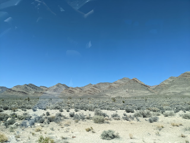
State Route 375 is a long desolate state highway that is North of Area 51. There is not allot out there but a road through the beautiful desert and a few thirsty cows.
|
 |
A view of the moon from our camp near McKinney Tanks Summit east of Tonopah Nevada |
 |
| Area 51, the AleInn off highway 375 |
|
For the record, I did keep an eye out for aliens but all I saw were some suspicious clouds.
On the way to Sonora Pass California
For the lunar eclipse we wanted to find a place with a good view so we decided to camp up as high as possible. We found a spot at 7,600 feet on the way to Sonora Pass that was off of Benton Crossing Road with amazing mountain views.
 |
| Sierra Mountains from our camping spot |
 |
| Our campsite for the eclipse |
 |
| A beautiful sunset |
Obsidian Dome, Eastern Sierras
We moved on to the Mammoth Lakes area and camped near Lee Vining.
Obsidian Dome is part of the June Lake Loop area near Inyo National Forest and was a fun hike. We started off-trail climbing up on top and then found the trail back down the other side. Climbing around was treacherous on unstable very sharp rock. The rock was amazing.
Sonora Pass, Eastern Sierras
We then started heading home by way of Sonora pass which had just opened two day earlier. There was nobody on the road and we found a great dispersed campsite up at the top near the climbing area.
 |
| Giant Sequoia are found up on Sonora pass!
|
After Sonora Pass we headed for home and the culture shock of traffic and too many humans. It was a great trip and we hope you enjoyed following along.


